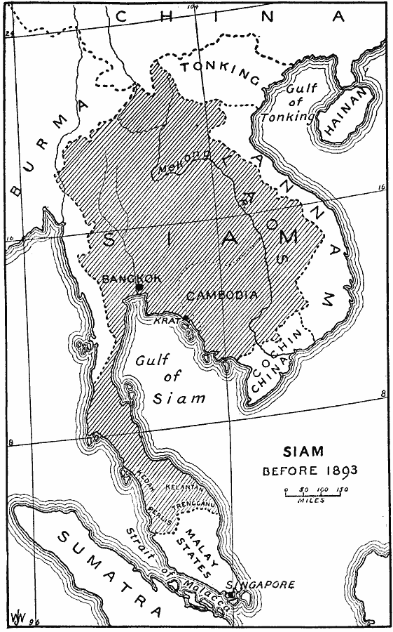
Description: A map of Siam (Thailand) prior to the Franco–Siamese War of 1893. This map shows that the Siamese territories at the time included Laos, Cambodia, and the central portion of the Malay Peninsula. "On the eastern peninsula of southern Asia, Siam is the only country which has preserved its independence against the encroachments of European eminent domain. Caught in a vise between British and French, what sovereignty they have managed to maintain the Siamese owe to the mutual jealousy of their neighbors. In the Anglo–French agreement of 1904, Siam, pared down to the narrowest possible limits, was left independent because French and British statesmen could not agree as to which should rule at Bangkok." — Gibbons, 1919, pp. 76-77.
Place Names: Southeastern Asia, Thailand, �Siam, �Cambodia, �Vietnam, �French Indochina, �Malaysia,�Burm
ISO Topic Categories: boundaries,
oceans,
inlandWaters,
location
Keywords: Siam prior to the Franco–Siamese War, physical, �political, physical features, country borders, boundaries,
oceans,
inlandWaters,
location, Unknown, Before 1893
Source: Herbert Adams Gibbons, The New Map of Asia (New York, NY: The Century Co., 1919) 84
Map Credit: Courtesy the private collection of Roy Winkelman |
|