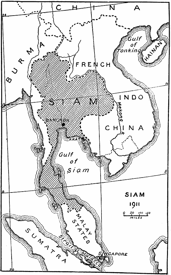
Description: A map of Siam (Thailand) in 1911 showing the borders established by the Anglo–French agreement (Entente cordiale) of 1904. The map shows the French control of Laos, Cambodia, and northern portions of former Siamese territories, and British expansion from Burma and territory in the Malay Peninsula. "The Anglo&ndas;French Convention of 1904, which settled moot questions all over the world, defined the attitude of France and Great Britain toward Siam. Siam was no more consulted in the matter than Egypt, Morocco, and the other countries whose future was being decided on. The two great colonial powers had exclusively in mind their own political and commercial interests. Great Britain recognized the right of France to extend her influence in the eastern provinces of Siam in return for French recognition of Great Britain's right to detach other Siamese territory in the neck of the peninsula." — Gibbons, 1919, pp. 83-84.
Place Names: Southeastern Asia, Thailand, �Siam, �French Indochina, �Burma, �Singapor
ISO Topic Categories: boundaries,
inlandWaters,
location,
oceans
Keywords: Paring Down Siam, physical, �political, physical features, country borders, boundaries,
inlandWaters,
location,
oceans, Unknown, 1911
Source: Herbert Adams Gibbons, The New Map of Asia (New York, NY: The Century Co., 1919) 84
Map Credit: Courtesy the private collection of Roy Winkelman |
|