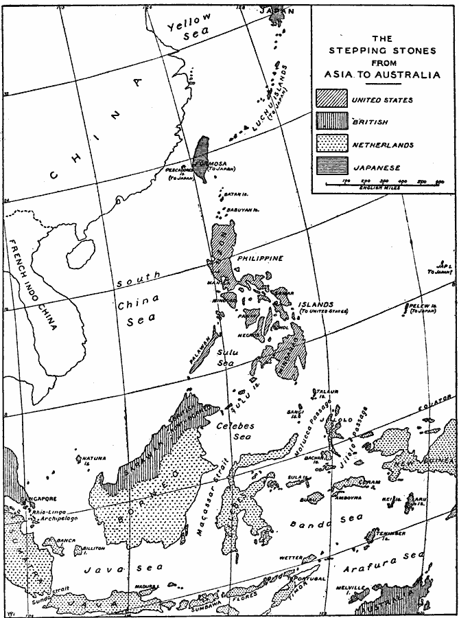
Description: A map from 1919 of the Asiatic islands from southern Japan to Australia showing the colonial holdings of Western nations in the region at the time, including the Philippines to the United States, Singapore, Sarawak, northern Borneo, and Australia to Britain, and Sumatra, Java, southern Borneo, Celebes, western New Guinea, and islands of the Banda Sea to the Netherlands. The map also shows the islands of Formosa (Taiwan) and Pelew under control of the Japanese.
Place Names: Southeastern Asia, China, �Indonesia, �Phillipines, �French Indochina, �Borneo, �Sarawak, �Sabah,�North Borneo, �Celebes, �New Guinea, �Java, �Sumnatr
ISO Topic Categories: boundaries,
inlandWaters,
location,
oceans
Keywords: Stepping Stones to Australia, physical, �political, physical features, country borders,
major political subdivisions, boundaries,
inlandWaters,
location,
oceans, Unknown, 1919
Source: Herbert Adams Gibbons, The New Map of Asia (New York, NY: The Century Co., 1919) 132
Map Credit: Courtesy the private collection of Roy Winkelman |
|