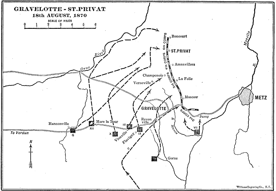
Description: A map of Gravelot – St. Privat in France on August 18, 1870, showing the military positions and movement of the largest battle of the Franco–Prussian War (1870–1871). The map shows the line of the French Army under Bazaine running south from Roncourt to the road between Verdun and Metz, and the routes of advance by the Prussian Army under Moltke. The Prussian victory prevented Bazaine from retreating to Verdun.
Place Names: France, Metz, �Gravelotte, �St. Privat, �Vionville, �Gorze, �Vernevill
ISO Topic Categories: boundaries,
inlandWaters,
location,
intelligenceMilitary
Keywords: Gravelotte-St.Privat, physical, �transportation, �franco-german war, �historical, kBattle, physical features, roads, other military, boundaries,
inlandWaters,
location,
intelligenceMilitary, Unknown, August 18, 1870
Source: Lucius Hudson Holt, Ph.D., The History of Europe from 1862 to 1914 (New York, NY: The Macmillan Company, 1918) 146
Map Credit: Courtesy the private collection of Roy Winkelman |
|