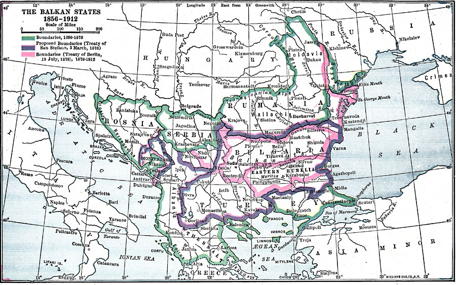
Description: A map showing the Balkan States, from the Treaty of Paris marking the end of the Crimean War in 1856 to 1912. This map shows the boundaries established in 1856 to 1878, the proposed boundaries established by the Treaty of San Stefano (March 3, 1878), and the boundaries established by the Treaty of Berlin on 13, July, 1878, which recognized independence for Romania, Serbia, and Montenegro, and autonomy for Bulgaria. The map shows the territories of Moldavia, Wallachia, Rumania, Bessarabia, Bulgaria, Eastern Rumelia, Bosnia, Montenegro, Serbia, Albania, Thessaly, and Turkey.
Place Names: Southeastern Europe, Romania, �Bulgaria, �Bosnia, �Serbia, �Turkey, �Russia, �Hungary, �Ital
ISO Topic Categories: boundaries,
inlandWaters,
location,
oceans
Keywords: The Balkan States, physical, �political, kEuropeanOttomanEmpire, physical features, country borders, boundaries,
inlandWaters,
location,
oceans, Unknown, 1856–1912
Source: Lucius Hudson Holt, Ph.D., The History of Europe from 1862 to 1914 (New York, NY: The Macmillan Company, 1918) 214
Map Credit: Courtesy the private collection of Roy Winkelman |
|