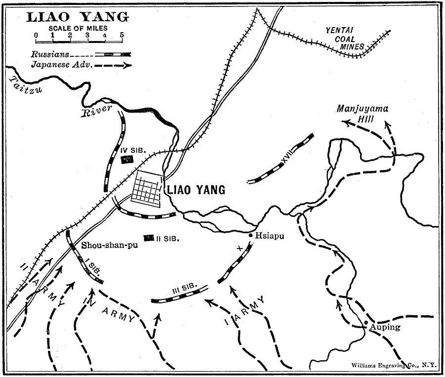
Description: A map of the battle site around the Manchurian city of Liao Yang during the Russo–Japanese War (1904–1905). Liao Yang was a strategic city along the Port Arthur–Mukden spur of the China Far East Railway that tied to the Trans–Siberian Railway. The map shows the Russian entrenchments south of the city, and the Japanese advances between August 24 and September 4, 1904 to Liao Yang. Also shown is the Taitzu River, the strategic Manjuyama Hill, the railroad spur to the Yentai coal mines, and the neighboring towns of Hsiapu and Auping.
Place Names: China, Liao Yang, �Shou-shan-pu, �Hsiapu, �Aupin
ISO Topic Categories: inlandWaters,
oceans,
location,
transportation,
intelligenceMilitary
Keywords: The Battle of Liao Yang, political, �physical, �transportation, �historical, �russo-japanese war, kBattle, physical features, local jurisdictions, roads,
railroads, other military, inlandWaters,
oceans,
location,
transportation,
intelligenceMilitary, Unknown, August 24 to September 4, 1904
Source: Lucius Hudson Holt, Ph.D., The History of Europe from 1862 to 1914 (New York, NY: The Macmillan Company, 1918) 358
Map Credit: Courtesy the private collection of Roy Winkelman |
|