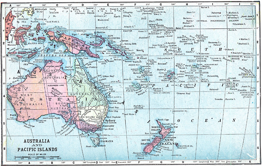
Description: A map of the Australia, the central Pacific Ocean and Oceania in 1903. The map shows the territorial possessions of Britain, France, Germany, and the United States in the region at the time. The map shows the Australian states, major cities and ports.
Place Names: Regional Pacific Ocean, Australia, �Indonesia, �Papua New Guinea, �New Zealand, �Marshal Islands, �Solomon Islands, �Kiribati, �French Polynesia, �Federated States of Micronesi
ISO Topic Categories: physical, �political, kWorldPacific
Keywords: Map of Australia and the Pacific Islands, physical, �political, physical features, country borders,
major political subdivisions, physical, �political, kWorldPacific, Unknown, 1903
Source: W. R. Hearst, The American Almanac, Yearbook Cycopedia and Atlas 2nd ed (Chicago, IL: Hearst's Chicago American, 1903) 280
Map Credit: Courtesy the private collection of Roy Winkelman |
|