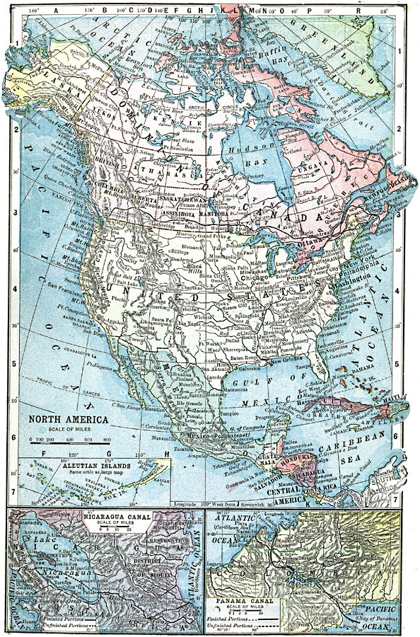
Description: A map from 1903 of North America. The focus of this map is the Dominions of Canada, showing the transportation network in from Montreal east to Quebec and Nova Scotia, and west to Vancouver, British Columbia. The map shows the territorial divisions of Canada at the time, including Yukon, Mackenzie, British Columbia, Athabasca, Alberta, Saskatchewan, Assiniboia, Manitoba, Keewatin, Ontario, Ungava, Quebec, and the territories of Newfoundland. The map includes inset maps detailing the Aleutian Islands, the Nicaragua Canal area, and Panama Canal area, showing the completed and unfinished portions of the canal projects at the time.
Place Names: A Complete Map of North America, Bahamas, �Canada, �Cuba, �Mexico, �United States, �Honduras, �Guatemala, �Nicaragua, �Costa Ric
ISO Topic Categories: boundaries,
inlandWaters,
location,
oceans,
transportation
Keywords: North America, physical, �political, �transportation, kTransportation, physical features, country borders, railroads, boundaries,
inlandWaters,
location,
oceans,
transportation, Unknown, 1903
Source: W. R. Hearst, The American Almanac, Yearbook Cycopedia and Atlas 2nd ed (Chicago, IL: Hearst's Chicago American, 1903) 281
Map Credit: Courtesy the private collection of Roy Winkelman |
|