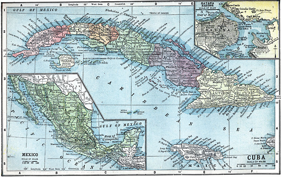
Description: A map from 1903 of Cuba, Isle of Pines and Jamaica, showing the provinces at the time, province capitals, major cities, towns and ports, railroads, mountains, rivers, coastal features, and smaller neighboring islands. An inset map details the capital city of Havana and Havana Harbor. A second inset map shows Mexico and the northern portion of Central America (Chiapas, Guatemala, and Honuras).
Place Names: A Regional Map of North America, Cuba, �Mexic
ISO Topic Categories: boundaries,
inlandWaters,
location,
oceans
Keywords: Cuba and Mexico, physical, �political, �transportation, kCaribbean, physical features, country borders,
local jurisdictions,
major political subdivisions, roads, boundaries,
inlandWaters,
location,
oceans, Unknown, 1903
Source: W. R. Hearst, The American Almanac, Yearbook Cycopedia and Atlas 2nd ed (Chicago, IL: Hearst's Chicago American, 1903) 352
Map Credit: Courtesy the private collection of Roy Winkelman |
|