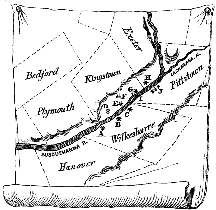
Description: Marks the site of Fort Durkee; B, Wyoming or Wilkesbarre Fort; C, Fort Ogden; D, village of Kingston; E, Forty Fort. F, the battleground; G, Wintermoot's Fort; H, Fort Jenkins; I, Monocasy Island; J, the three Pittstown stockades. — Pictorial Field-Book of the Revolution Vol.I, 1851
Place Names: Pennsylvania, Lackawana River, �exeter, �Kingstown, �Bedford, �Plymouth, �Hanover, �Wilkesharre, �Pittstown, �Susquenna River,
ISO Topic Categories: inlandWaters,
location,
structure,
intelligenceMilitary
Keywords: Position of the Wyoming Forts, physical, �historical, physical features, American Revolution, inlandWaters,
location,
structure,
intelligenceMilitary, Unknown, 1770s
Source: Benson J. Lossing, Pictorial Field-Book of the Revolution Vol. I (New York, NY: Harper and Brothers, 1851) 353
Map Credit: Courtesy the private collection of Roy Winkelman |
|