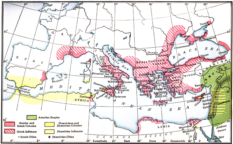
Description: A map showing the Colonial Expansion of the Greeks and Phoenicians down to the Sixth Century B.C., color–coded to distinguish between the Assyrian, Greek, and Phoenician lands.
Place Names: Regional Mediterranean, Africa, �Arcadia, �Athens, �Crete, �Cyprus, �Damascus, �Greece, �Liby
ISO Topic Categories: borders, �physical, kWorldMedSea, kWorldAfroAsia, kWorldEurasia, kWorldEuroAfrica
Keywords: Colonial Expansion of the Greeks and Phoenicians, borders, �physical, borders, �physical, kWorldMedSea, kWorldAfroAsia, kWorldEurasia, kWorldEuroAfrica, Unknown, Sixth Century B.C.
Source: James Henry Breasted, Ph.D., LL.D., Ancient Times - A History of the Early World (Boston, MA: Ginn and Company, 1916)
Map Credit: Courtesy the private collection of Roy Winkelman |
|