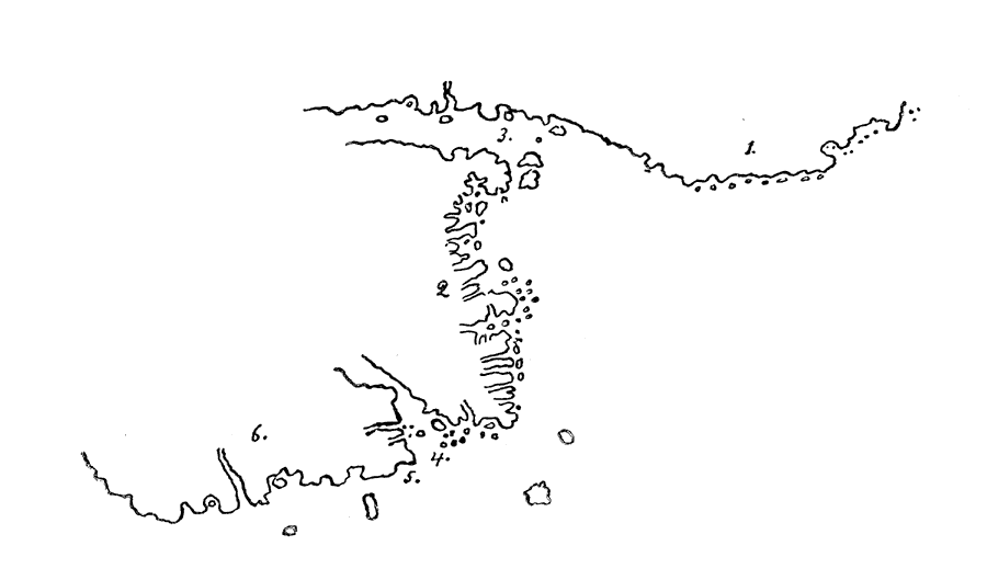
Description: A facsimile sketch of an early Portuguese map showing the Maine coastline between 1514–1520. The map is keyed to show: (1) Do Lavrador (Labrador); (2) Bacaluaos (east coast of Newfoundland); (3) (Straits of Belle Isle); (4) (South entrance to Gulf of St. Lawrence); (5) (Land discovered by the Bretons); (6) (Nova Scotia). — Narrative and Critical History of America Vol. III, 1884.
Place Names: Maine, Portuguese, Portolano, �Do Lavrador, �Labrador, �Bacaluaos, �Newfoundland, �Straits of Elle Isle, �Gulf of St. Lawrence, �Nova Scotia,
ISO Topic Categories: inlandWaters,
location
Keywords: Portuguese Portolano, physical, kEarlyMapsFacsimile, physical features, inlandWaters,
location, Unknown, 1514–1520
Source: Justin Winsor, Narrative and Critical History of America Vol. III (Boston, MA: Houghton, Mifflin and Company, 1884) 56
Map Credit: Courtesy the private collection of Roy Winkelman |
|