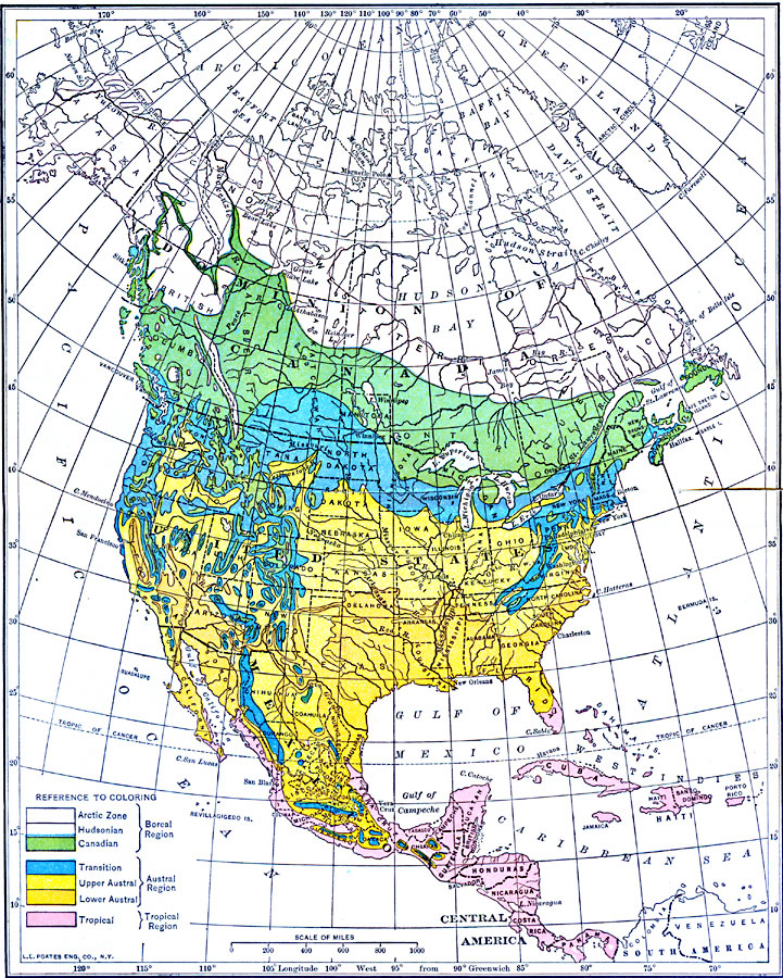
Description: A map from 1911 of North America and Central America showing the seven climate zones and three life provinces in the region. The map is color–coded to show the Arctic, Hudsonian, and Canadian climate zones (Boreal Region), Transition, Upper Austral, and Lower Austral climate zones (Austral Region), and the Tropical climate zone (Tropical Region).
Place Names: A Complete Map of North America, Canada, �Cuba, �United States, �Mexico, �Bahamas, �Haiti, �Honduras, �Nicaragua, �Panam
ISO Topic Categories: boundaries,
climatologyMeteorologyAtmosphere,
inlandWaters,
location,
oceans
Keywords: Climate and Life Provinces of North America, physical, �political, �meteorological, kClimate, kBiodiversity, physical features, country borders,
major political subdivisions, climate, boundaries,
climatologyMeteorologyAtmosphere,
inlandWaters,
location,
oceans, Unknown, 1911
Source: Isaiah Bowman, Ph. D., Forest Physiography (New York, NY: John Wiley and Sons, 1911) front plate
Map Credit: Courtesy the private collection of Roy Winkelman |
|