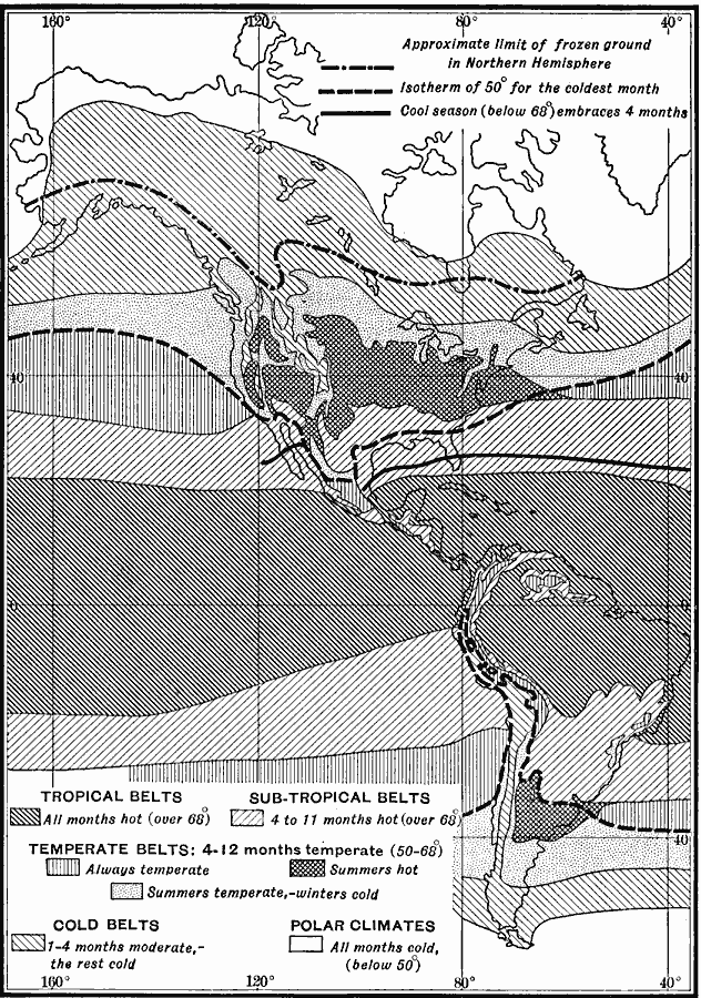
Description: A map from 1911 of North and South America showing the climate belts of the region. The map is keyed to show the Tropical belts where mean temperatures are hot (over 68° Fahrenheit) all year, Sub–Tropical belts where mean temperatures over 68° occur 4 to 11 months of the year, and Temperate belts where temperatures average 50–68° for 4 to 12 months, including areas of constant temperate temperatures, areas of hot summers, and areas of temperate summers and cool winters. The map also shows the cold belts where 1 to 4 months are moderate, the rest of the year cold, and the areas of polar climate where all months are below 50° Fahrenheit. The map shows the approximate limit of frozen ground in the northern hemisphere, the isotherm of 50° for the coldest month, and the boundary of the area where the cool season (below 68°) embraces 4 months.
Place Names: Regional Americas, North America, �South Americ
ISO Topic Categories: physical, �meteorological, kClimate, kWorldAmericas
Keywords: Temperature Zones of North and South America, physical, �meteorological, kClimate, physical features, climate,
temperature, physical, �meteorological, kClimate, kWorldAmericas, Unknown, 1911
Source: Isaiah Bowman, Ph. D., Forest Physiography (New York, NY: John Wiley and Sons, 1911)
Map Credit: Courtesy the private collection of Roy Winkelman |
|