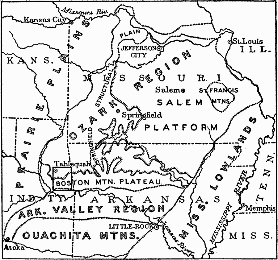
Description: The subdivisions of the Ozark region and relations to surrounding provinces.
Place Names: Western States, St. Louis, �Kansas City, �Springfield, �Missouri, �Arkansas,
ISO Topic Categories: boundaries,
inlandWaters,
location
Keywords: The Ozarks, physical, �political, physical features,
topographical, major political subdivisions, boundaries,
inlandWaters,
location, Unknown, 1911
Source: Isaiah Bowman, Ph. D, Forest Physiography (New York, NY: John Wiley and Sons, 1911) 452
Map Credit: Courtesy the private collection of Roy Winkelman |
|