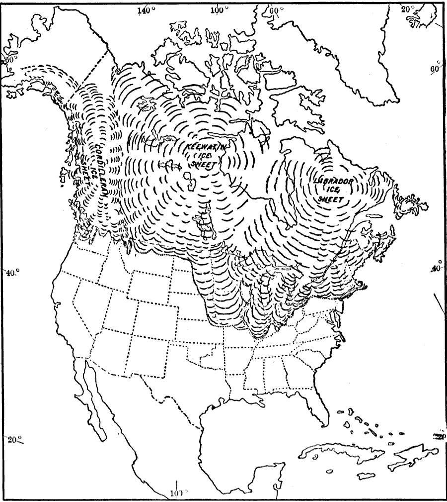
Description: A map from 1911 showing the centers of ice accumulation, the position of the Driftless Area, the general direction of radiation, and the southern limit of glaciation in North America during the last glacial period. The map shows the Cordilleran Ice Sheet centered in northern British Columbia, the Keewatin Ice Sheet west of Hudson Bay, and the Labrador Ice Sheet over the Labrador Peninsula.
Place Names: A Complete Map of North America, glaciers, �glaciation, �global warmin
ISO Topic Categories: climatologyMeteorologyAtmosphere,
location,
oceans
Keywords: Southern Limit of Glaciation, physical, �political, �glaciers, kGlacial, physical features, country borders,
major political subdivisions, climatologyMeteorologyAtmosphere,
location,
oceans, Unknown, 1911
Source: Isaiah Bowman, Ph. D, Forest Physiography (New York, NY: John Wiley and Sons, 1911) 465
Map Credit: Courtesy the private collection of Roy Winkelman |
|