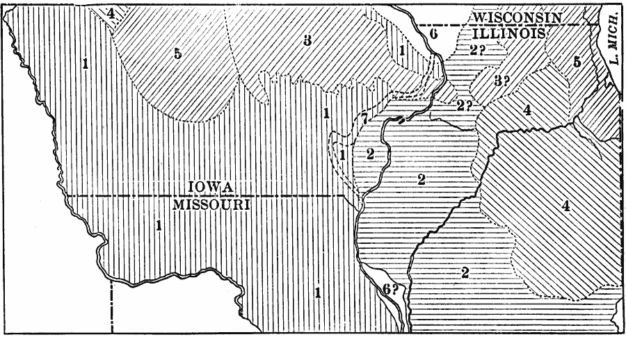
Description: The relations of the drift sheets of Iowa and northern Illinois. 1, Kansan; 2, Illinoian; 3, Iowan; 4, Early Wisconsin; 5, Late Wisconsin; 6, Driftless area; 7, course of the Mississippi River during the Illinoian glacial epoch.
Place Names: Midwest States, Wisconsin, �Illinois, �Iowa, �Missour
ISO Topic Categories: boundaries,
location,
inlandWaters,
geoscientificInformation
Keywords: Drift Sheets of Iowa and Northern Illinois, physical, kGlacial, physical features, boundaries,
location,
inlandWaters,
geoscientificInformation, Unknown, 1911
Source: Isaiah Bowman, Ph. D, Forest Physiography (New York, NY: John Wiley and Sons, 1911) 473
Map Credit: Courtesy the private collection of Roy Winkelman |
|