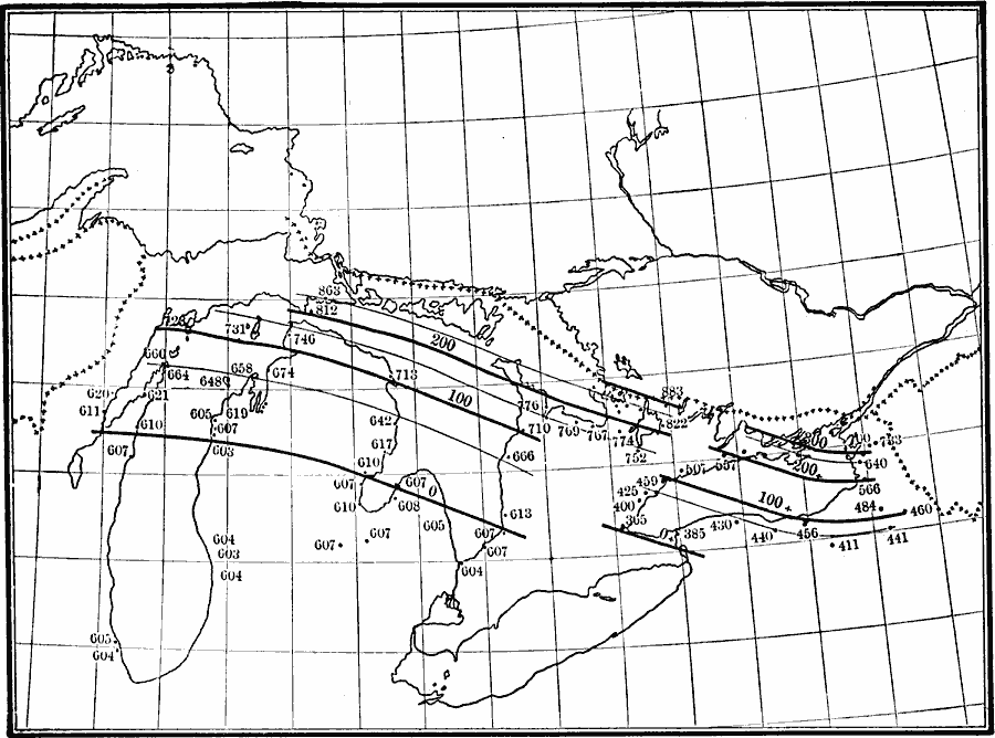
Description: An isobaric map of the Algonkian and Iroquois beaches, showing the broader features of warping numbers. Numbers indicate elevation of raised beaches above the sea.
Place Names: Midwest States, Michigan, �Minnesot
ISO Topic Categories: elevation,
boundaries,
geoscientificInformation,
inlandWaters,
location
Keywords: Algonkian and Iroquois Beaches, physical, �political, kGlacial, physical features, country borders, elevation,
boundaries,
geoscientificInformation,
inlandWaters,
location, Unknown, 1911
Source: Isaiah Bowman, Ph. D, Forest Physiography (New York, NY: John Wiley and Sons, 1911) 484
Map Credit: Courtesy the private collection of Roy Winkelman |
|