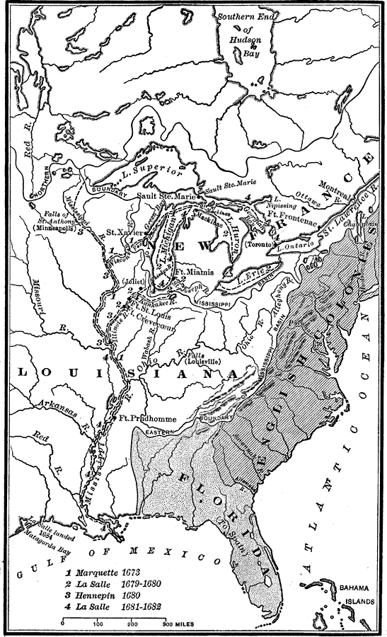
Description: Eastern section of North America, noting the areas along the Mississippi River explored by the French during the late seventeenth century.
Place Names: A Regional Map of North America, Bahamas, �Canada, �Florida, �Louisiana, �New France, �United State
ISO Topic Categories: location,
inlandWaters,
oceans,
boundaries
Keywords: French Explorations of the Mississippi, discovery, �historical, �location, �physical, �political, physical features, major political subdivisions, historical event, location,
inlandWaters,
oceans,
boundaries, Unknown, 1673–1682
Source: Nathaniel Wright Stephenson, An American History (Boston, MA: Ginn and Company, 1913) 98
Map Credit: Courtesy the private collection of Roy Winkelman |
|