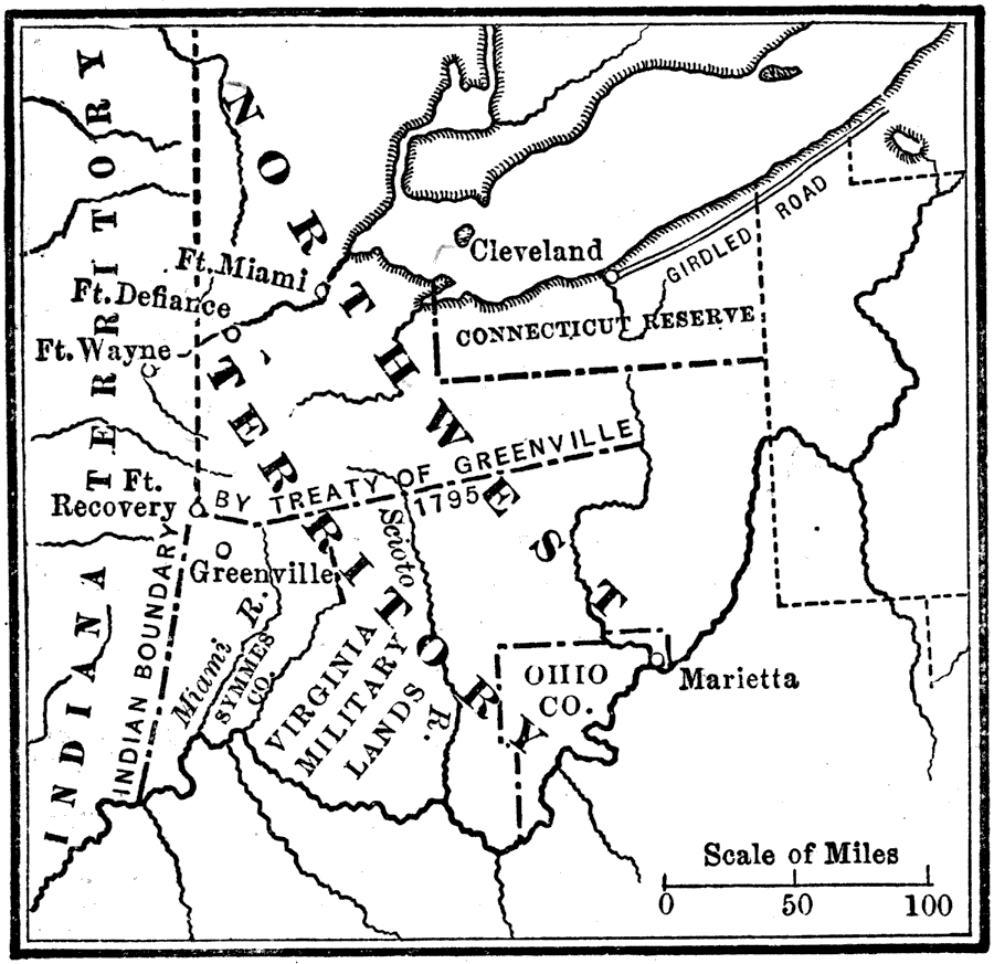
Description: A map of the Northwest Territory of the United States north of the Ohio River, including areas of southern and eastern Ohio given up by Indians in the Treaty of Greenville in 1795. The region west of Ohio was organized in 1802 as the Territory of Indiana. The map shows the territories of the Connecticut Reserve, Symmes Company, Virginia Military Lands, and the Ohio Company. Also shown are the settlements and forts of Marietta, Greenville, Fort Recovery, Fort Wayne, Fort Defiance, Fort Miami, and Cleveland with the ‘Girdled Road,’ the first road that early European settlers built between Cleveland and the Pennsylvania line.
Place Names: Growth of Nation, Cleveland, �Defiance, �Fort Wayne, �Greenville, �Indiana, �Marietta, �Ohio, �Virginia, �Treaty of Indiana, �Treaty of Greenville,
ISO Topic Categories: location,
inlandWaters,
oceans,
boundaries
Keywords: The Northwest Territory, historical, �location, �physical, �political, physical features, major political subdivisions, historical event, location,
inlandWaters,
oceans,
boundaries, Unknown, 1802
Source: Nathaniel Wright Stephenson, An American History (Boston, MA: Ginn and Company, 1913) 254
Map Credit: Courtesy the private collection of Roy Winkelman |
|