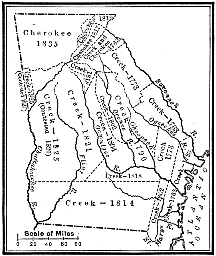
Description: A map of Georgia showing the cessions of Cherokee and Creek territories and the dates of treaties.
Place Names: Georgia,
ISO Topic Categories: location,
inlandWaters,
oceans,
boundaries
Keywords: Indian Cessions in Georgia, historical, �physical, �political, kNativeAmerican, physical features, major political subdivisions, historical event,
other military, location,
inlandWaters,
oceans,
boundaries, Unknown, 1733–1835
Source: Nathaniel Wright Stephenson, An American History (Boston, MA: Ginn and Company, 1913) 341
Map Credit: Courtesy the private collection of Roy Winkelman |
|