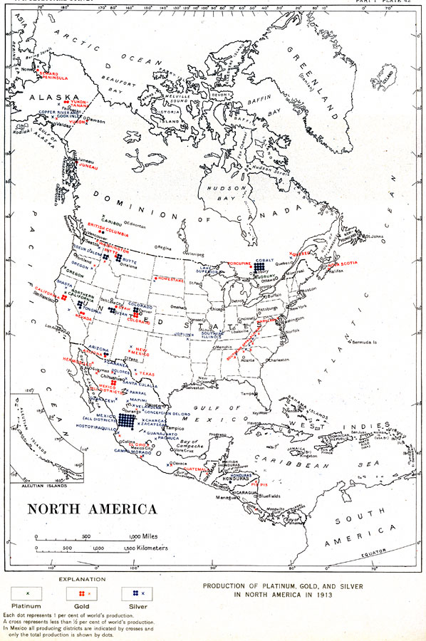
Description: "Production of platinum, gold, and silver in North America in 1913... Each dot represents 1 per cent of world's production. A cross represents less than 1/2 per cent of world's production. In Mexico all producing districts are indicated by crosses and only the total production is shown by dots." — Department of the Interior, 1921
Place Names: A Complete Map of North America, Bahamas, �Canada, �Cuba, �Mexico, �United State
ISO Topic Categories: boundaries,
economy,
inlandWaters,
oceans
Keywords: Production of Platinum, Gold, and Silver in North America, physical, �political, �statistical, physical features,
geological, country borders, industry,
economic, boundaries,
economy,
inlandWaters,
oceans, Unknown, 1913
Source: Department of the Interior , World Atlas of Commercial Geology (Washington, DC: Department of the Interior , 1921) Plate 42
Map Credit: Courtesy the private collection of Roy Winkelman |
|