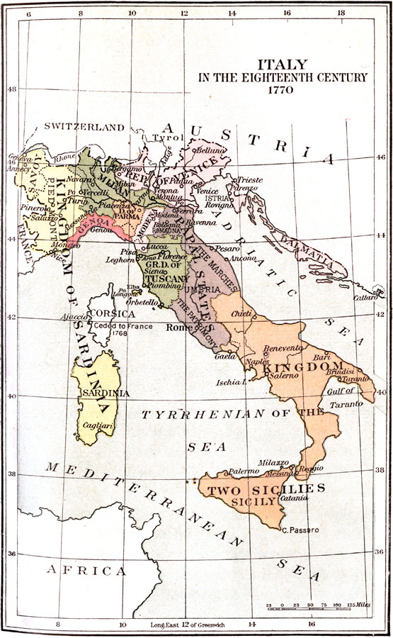
Description: "Indeed, there was no Italy, no united, single country, but only a collection of petty states...Once masters in their own house, the Italians had long ago fallen from their high estate and had for centuries been in more or less subjection to foreigners, to Spaniards, to Austrians, sometimes to the French...They had no great attachment to their governments, save possibly in Piedmont and in the republics of Venice and Genoa, and there was no reason why they should have. Several of the governments were importations from abroad, or rather impositions, which had never struck root in the minds or interests of the peoples. The political atmosphere was one of indifference, weariness, disillusionment." — Hazen, 1917
Place Names: Italy, Bologna, �Florence, �Genoa, �Messina, �Naples, �Rome, �Venice, �Verona, �Kingdom of the Two Sicilies, �Kingdom of Sardinia, �Grand Duchy of Tuscany, �Papal States, �Republic of Genoa, �Republic of Venice, �Duchy of Parma, �Duchy of Modena, �Dalmatia, �
ISO Topic Categories: boundaries,
inlandWaters
Keywords: Italy in the Eighteenth Century, physical, �political, �historical, physical features, local jurisdictions,
major political subdivisions, boundaries,
inlandWaters, Unknown, 1770
Source: Charles Downer Hazen, The French Revolution and Napoleon (New York, NY: Henry Holt and Company, 1917) 14
Map Credit: Courtesy the private collection of Roy Winkelman |
|