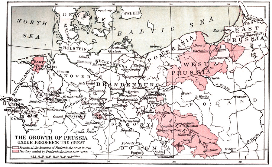
Description: A map of northern Germany showing Prussia at the Accession of Frederick the Great in 1740 and the territory added by Frederick the Great between 1740 and 1786. Also shown are East Friesland, Brandenburg, Pomerania, and Silesia.
Place Names: Central Europe, Denmark, �Netherlands, �East Friesland, �Brandenburg, �Pomerania, �West Prussia, �Silesia, �Poland, �East Prussia, �Saxony, �Bohemia,
ISO Topic Categories: boundaries,
inlandWaters
Keywords: The Growth of Prussia Under Frederick the Great, physical, �political, �historical, physical features, major political subdivisions, boundaries,
inlandWaters, Unknown, 1740–1786
Source: Charles Downer Hazen, The French Revolution and Napoleon (New York, NY: Henry Holt and Company, 1917) 26
Map Credit: Courtesy the private collection of Roy Winkelman |
|