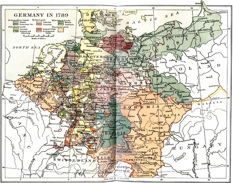
Description: Map of Germany at the onset of the French Revolution (1789) under the rule of Frederick II. This map highlights the Hohenzollern Lands (Prussia, Franconian Line), Oldenburg Lands (Denmark, Holstein, and Oldenburg), Wettin Lands (Albertine and Ernestine), Wittelsbach Lands (Bavaria and Palatinate), Imperial Cities, Ecclesiastical States, and Hapsburg Lands.
Place Names: Germany, Berlin, �Bremen, �Cologne, �Dresden, �Frankfurt am Main, �Hamburg, �Hannover, �Mannheim, �Nuremberg, �Wiesbaden, �Austrian Netherlands, �United Netherlands, �Tyrol, �Rhine River, �Elbe River, �Danube River, �Wesser River, �Silesia, �Prussia, �Bohemia,
ISO Topic Categories: boundaries,
inlandWaters,
oceans
Keywords: Germany, physical, �political, �historical, physical features, country borders,
major political subdivisions,
local jurisdictions, boundaries,
inlandWaters,
oceans, Unknown, 1789
Source: Charles Downer Hazen, The French Revolution and Napoleon (New York, NY: Henry Holt and Company, 1917) 32
Map Credit: Courtesy the private collection of Roy Winkelman |
|