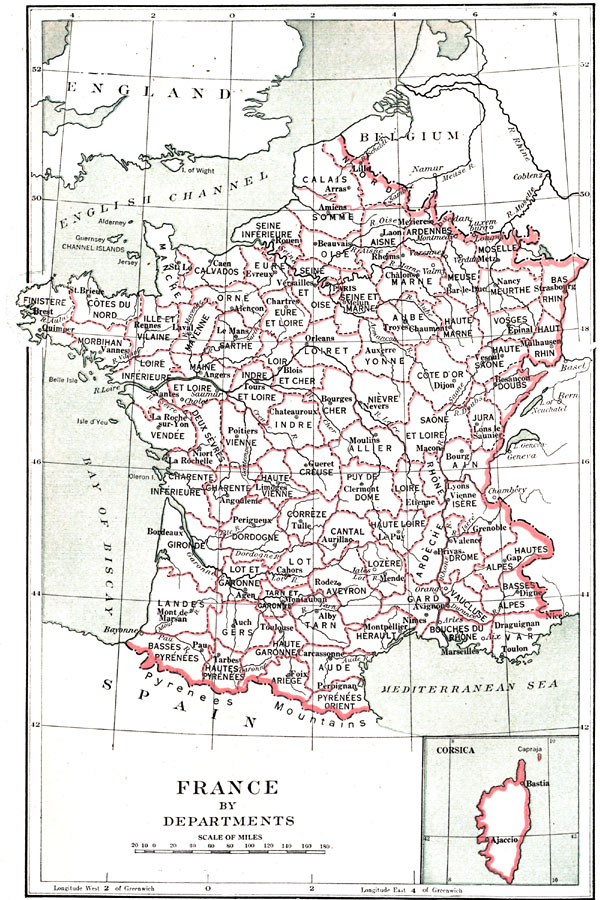
Description: A map of France at the time of the Constitution of 1791, including an inset of the Corsican department. "For the purpose of administration and local government a new system was established. The old thirty–two provinces were abolished and France was divided into eighty–three departments of nearly uniform size. The departments were divided into arrondissements, these into cantons, and these into municipalities or communes. These are the terms which have ever since been in vogue." — Hazen, 1917
Place Names: France, Bordeaux, �Dunkerque, �Grenoble, �Lyon, �Nice, �Nancy, �Orleans, �Paris, �Starsbourg, �Tours, �River Seine, �River Loire, �River Garonne, �River Rohne, �Bay of Biscay, �Corsic
ISO Topic Categories: boundaries,
inlandWaters
Keywords: France by Departments, physical, �political, �historical, physical features, country borders,
major political subdivisions,
local jurisdictions, boundaries,
inlandWaters, Unknown, 1791
Source: Charles Downer Hazen, The French Revolution and Napoleon (New York, NY: Henry Holt and Company, 1917) 140
Map Credit: Courtesy the private collection of Roy Winkelman |
|