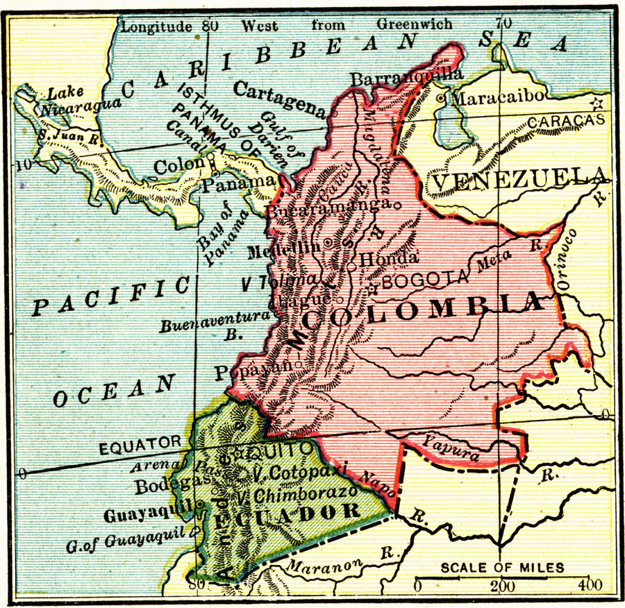
Description: Overview map of Colombia and Ecuador relative to Panama, Venezuela, Caribbean Sea, and Pacific Ocean. Major cities, major rivers, and Andes also shown. "Colombia is nearly ten times as large as the state of New York. It is as long from north to south as the distance from St. Paul to New Orleans, and its coast line on the Caribbean Sea and the Pacific Ocean is longer than the distance from New York to Chicago. It is a land of mountains and plains. The Andes run through it in three high ranges, and between them are some of the most fertile river valleys of all South America...The exact size of Ecuador is unsettled. According to the boundaries which the natives claim, it is larger than Texas; but if Peru and Colombia are allowed what they assert belongs to them it will be but a little larger than Colorado." — Carpenter, 1915
Place Names: Colombia, Barranquilla, �Bogota, �Cartagena, �Ecuador, �Quito, �Guayaquil,
ISO Topic Categories: boundaries,
inlandWaters,
oceans
Keywords: Colombia and Ecuador, physical, �political, physical features,
topographical, country borders, boundaries,
inlandWaters,
oceans, Unknown, 1915
Source: Frank G. Carpenter, Carpenter's Geographical Reader: South America (New York, NY: American Book Company, 1915) 30
Map Credit: Courtesy the private collection of Roy Winkelman |
|