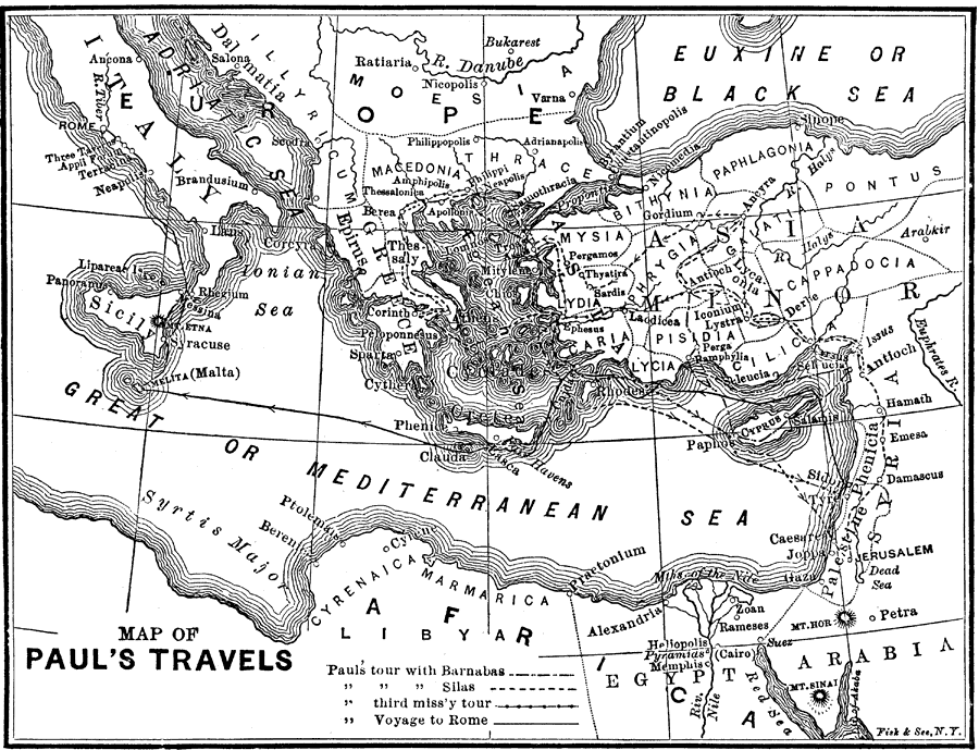
Description: The travels of Paul the Apostle, including Paul's tour with Barnabas, Paul's tour with Silas, Paul's third missionary tour, and Paul's voyage to Rome.
Place Names: Miscellaneous Asia, Jerusalem, �Damascus, �Antioch, �Lydia, �Cilica, �Tarsus, �Berea, �Thessaly, �Athens, �Melita, �Malta, �Messina, �Rome,
ISO Topic Categories: boundaries,
inlandWaters,
oceans,
society,
transportation
Keywords: Paul's Travels, physical, �political, �transportation, �historical, physical features, country borders,
major political subdivisions, roads,
water routes, boundaries,
inlandWaters,
oceans,
society,
transportation, Unknown, 10 BC–AD 67
Source: W. H. DePuy, People's Cyclopedia of Universal Knowledge: V.2 (New York, NY: Phillips & Hunt, 1881) 1337
Map Credit: Courtesy the private collection of Roy Winkelman |
|