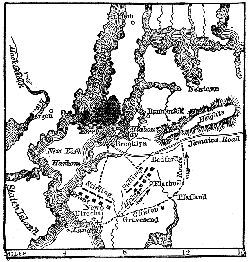
Description: A map of Long Island showing the sites of the Battle of Long Island (August 27, 1776). "On August 22 the British landed on Long Island, near Utrecht, 10,000 strong. The patriots, some 8,000 strong, were assembled near Brooklyn, under the command of Gens. Sullivan and Stirling. On the morning of August 27 the British advanced by three roads; their plan of attack was skillfully laid, and they completely defeated the Americans, whose two commanding generals were killed." — W. H. DePuy, 1881.DePuy, 1881
Place Names: New York, New York City, �Brooklyn, �Hudson River, �Staten Island, �New Utrecht, �Flatbus
ISO Topic Categories: society,
inlandWaters
Keywords: Battle of Long Island, physical, �transportation, �historical, kAmericanRevolution, physical features,
topographical, roads, American Revolution, society,
inlandWaters, Unknown, August 22–27, 1776
Source: W. H. DePuy, People's Cyclopedia of Universal Knowledge: V.2 (New York, NY: Phillips & Hunt, 1881) 1488
Map Credit: Courtesy the private collection of Roy Winkelman |
|