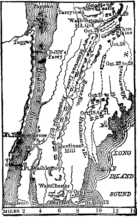
Description: The Revolutionary Battle of Long Island and Howe's advance on Washington's headquarters near White Plains.
Place Names: New York, New York City, �Valentines Hill, �Fort Independence, �Tarrytown, �White Plains, �Long Island Sound, �Hudson Rive
ISO Topic Categories: inlandWaters,
society
Keywords: Scene of Operation around New York, physical, �transportation, �historical, physical features,
topographical, roads,
water routes, American Revolution, inlandWaters,
society, Unknown, 1776
Source: W. H. DePuy, People's Cyclopedia of Universal Knowledge: V.2 (New York, NY: Phillips & Hunt, 1881) 1488
Map Credit: Courtesy the private collection of Roy Winkelman |
|