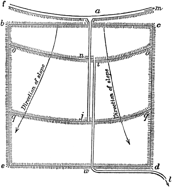
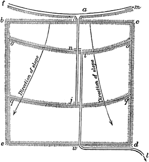
Irrigation by Checks
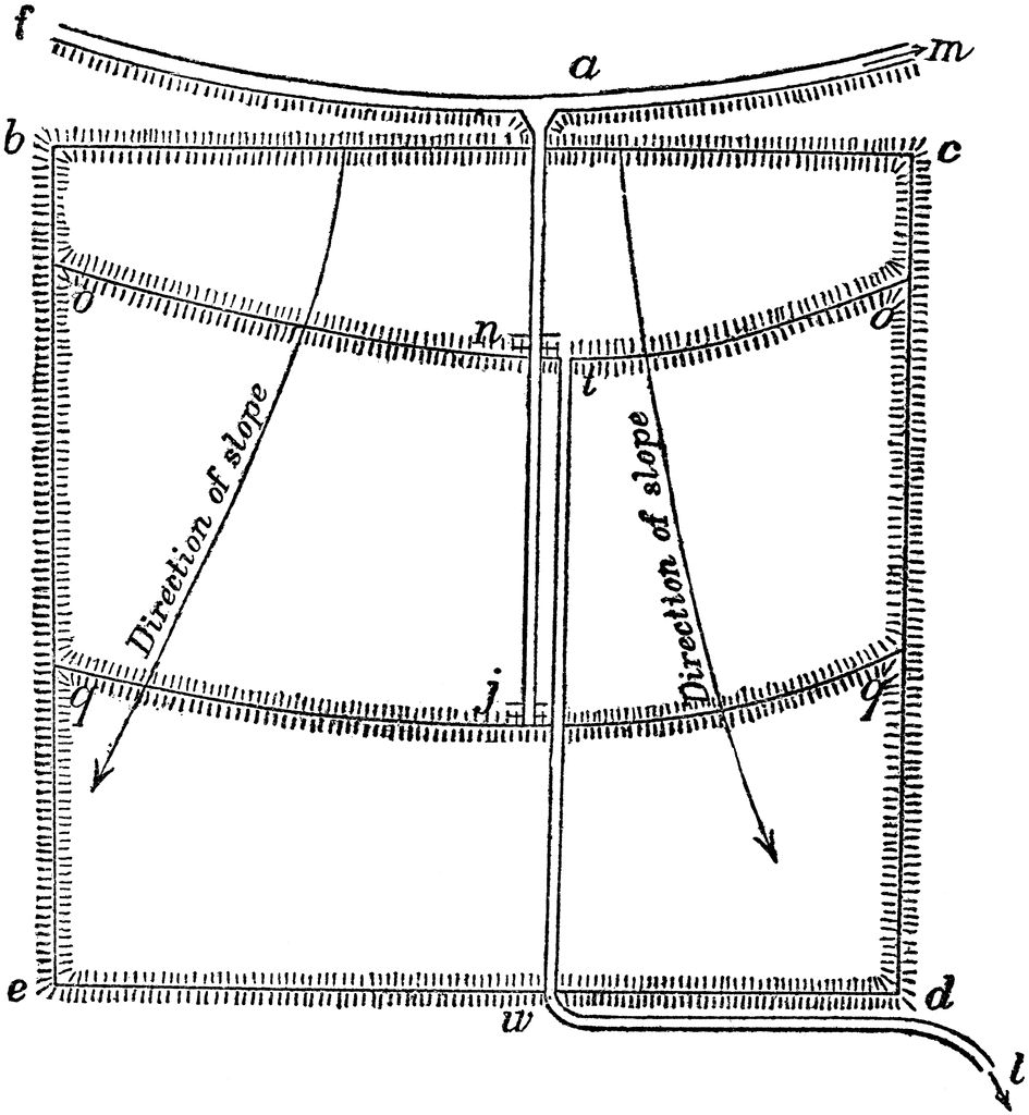
“A modification of the basin plan, as applied to ground with considerable slope and consisting of hillside land, wherein f m is the main ditch on the highest side of the field, of which b c d e mark the boundaries. Its surface slopes in the direction of the arrows; o o and q q are “check levees,” or slight embankments, built on level lines around the curved surfaces of the field. A supply ditch, i j, leads the water into the ‘checks’ or basins b c, o o, and q q, etc., and t w l is a waste ditch for discharging the surplus water from the checks when no longer needed.” -Department of Agriculture
Keywords
irrigation by checks, basin plan, agriculture diagram, main ditch, check levees, embankments, supply ditchGalleries
IrrigationSource
Department of Agriculture Yearbook of the United States (Washington, DC: Government Printing Office, 1896)
Downloads
2216×2400, 724.8 KiB
945×1024, 111.7 KiB
590×640, 58.0 KiB
295×320, 20.7 KiB