Topographic Architect Map
| View Cart ⇗ | Info

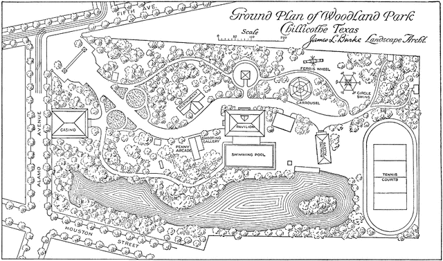
An architect’s landscape map of a Texas Park illustrating a combination of conventional topographic map symbols.
Keywords
map, maps, topography map, topographic map, Architect's Map, Engineering Map, Park Map, parksSource
French, Thomas E A Manual of Engineering Drawing for Students and Draftsmen (New York, NY: McGraw-Hill, 1911)
Downloads
2400×1416, 976.8 KiB
1024×604, 183.3 KiB
640×377, 85.5 KiB
320×188, 24.5 KiB