This science ClipArt gallery offers 119 images of topography, which is the study of the Earth's surface. This is most often seen in map-making, when representing features of the Earth is represented by symbols.
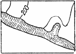
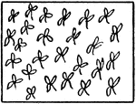
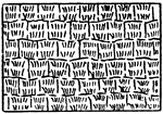
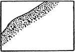
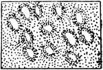
The typical representation of bamboo on a topographical map.

Bamboo

The typical representation of bamboo on a topographical map.

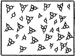
The typical representation of banana on a topographical map.

Banana

The typical representation of banana on a topographical map.

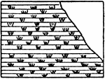
The typical representation of bluffs (other than rocky) on a topographical map.

Bluffs, Other than Rocky

The typical representation of bluffs (other than rocky) on a topographical map.

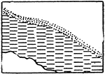
The typical representation of rocky bluffs on a topographical map.

Rocky Bluffs

The typical representation of rocky bluffs on a topographical map.

The typical representation of cactus on a topographical map.

Cactus

The typical representation of cactus on a topographical map.

Contour lines never cross on the ground but in rare cases as an overhanging cliff they may cross on the map.

Contour Lines

Contour lines never cross on the ground but in rare cases as an overhanging cliff they may cross on…

A contour about to cross a stream runs up one side and down the other, making a V where it crosses, the angle of the V pointing up stream. Contour lines representing spurs between stream lines are generally U shaped with the bottom or rounded part of the U pointing down hill.

Contour Lines

A contour about to cross a stream runs up one side and down the other, making a V where it crosses,…
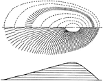
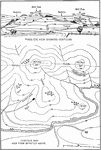
topography map, contour map, bird's eye view

Contour Map

topography map, contour map, bird's eye view

"The contours are sketched lightly in pencil and the hachures drawn perpendicular to them, starting at the summit and making heavier strokes for steeper slopes. The rows of strokes should touch the pencil line, to avoid white streaks along the contours." —French, 1911

Shoreline Contour Map Method of Execution

"The contours are sketched lightly in pencil and the hachures drawn perpendicular to them, starting…

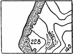
A map of a shoreline created by using contour lines creating hills.

Shoreline Contour Map

A map of a shoreline created by using contour lines creating hills.

"The showing of relief by means of hill shading gives a pleasing effect but is very difficult of execution, does not give exact elevations and would not be applied on maps to be used for engineering purposes. They may sometimes be used to advantage in reconnoissance maps, or in small scale maps for illustration." —French, 1911

Shoreline Hill Shading by Hachures Contour Map

"The showing of relief by means of hill shading gives a pleasing effect but is very difficult of execution,…
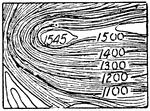
In cartography, a contour line (often just called a "contour") joins points of equal elevation (height) above a given level, such as mean sea level. A contour map is a map illustrated with contour lines, for example a topographic map, which thus shows valleys and hills, and the steepness of slopes. The contour interval of a contour map is the difference in elevation between successive contour lines.

Contour System

In cartography, a contour line (often just called a "contour") joins points of equal elevation (height)…

"A contour is a line on the surface of the ground which at every point passes through the same elevation, thus the shore line of a body of water represents a contour. If the water should rise one foot the new shore line would be another contour, with foot 'contour interval.'" —French, 1911

Shoreline Contour

"A contour is a line on the surface of the ground which at every point passes through the same elevation,…
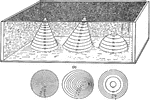
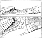
The diagram shows the principles of contours. The cones and domes from the side (a) are translated to topography (b).

Contours

The diagram shows the principles of contours. The cones and domes from the side (a) are translated to…
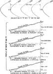
Showing relief on a map using contours.

Contours

Showing relief on a map using contours.

Contour lines.

Contours

Contour lines.

This diagram shows the translation of contours to finding the measurement of the slope in grade percent, mils, degrees, and gradient.

Contours to Slope

This diagram shows the translation of contours to finding the measurement of the slope in grade percent,…
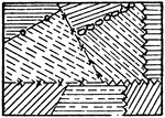
The typical representation of coral reef on a topographical map.

Coral Reef

The typical representation of coral reef on a topographical map.

The typical representation of corn on a topographical map.

Corn

The typical representation of corn on a topographical map.

The typical representation of cotton on a topographical map.

Cotton

The typical representation of cotton on a topographical map.

The typical representation of cultivated fields in general on a topographical map.

Cultivated Fields in General

The typical representation of cultivated fields in general on a topographical map.

Determining a defilade (natural shield) in military by use of topography.

Defilade

Determining a defilade (natural shield) in military by use of topography.

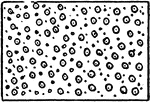
The typical representation of depression contours, if otherwise ambiguous, on a topographical map.

Depression Contours

The typical representation of depression contours, if otherwise ambiguous, on a topographical map.

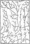
"Drainage which has been influenced by joints." -Walcott, 1901

Drainage Streamlets

"Drainage which has been influenced by joints." -Walcott, 1901

The typical representation of eel grass on a topographical map.

Eel Grass

The typical representation of eel grass on a topographical map.

"View of the southeastern slope of the eastern twin of Orenaug Hill. Fault scarps bound the hummocky surface of the block on the northeast and west; the courses of the scarps follow the fringes of trees." -Walcott, 1901

Fault Scarp Slope

"View of the southeastern slope of the eastern twin of Orenaug Hill. Fault scarps bound the hummocky…

"Fault scarps of Orenaug Hill (floating block topography). The view is taken from the top of a cliff in the eastern twin hill." -Walcott, 1901

Fault Scarps

"Fault scarps of Orenaug Hill (floating block topography). The view is taken from the top of a cliff…
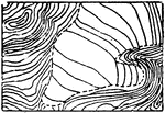
In cartography, a contour line (often just called a "contour") joins points of equal elevation (height) above a given level, such as mean sea level. A contour map is a map illustrated with contour lines, for example a topographic map, which thus shows valleys and hills, and the steepness of slopes. The contour interval of a contour map is the difference in elevation between successive contour lines.

Glacier Contours

In cartography, a contour line (often just called a "contour") joins points of equal elevation (height)…

In cartography, a contour line (often just called a "contour") joins points of equal elevation (height) above a given level, such as mean sea level. A contour map is a map illustrated with contour lines, for example a topographic map, which thus shows valleys and hills, and the steepness of slopes. The contour interval of a contour map is the difference in elevation between successive contour lines.

Glacier Form Lines

In cartography, a contour line (often just called a "contour") joins points of equal elevation (height)…
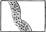
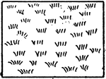
The typical representation of grasslands on a topographical map.

Grassland in General

The typical representation of grasslands on a topographical map.

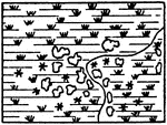
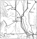
The typical representation of shores and low-water lines with gravel and rocks on a topographical map.
Gravel and Rocks

The typical representation of shores and low-water lines with gravel and rocks on a topographical map.

Showing relief on a map using hachures: short parallel lines. Close together is a steeper incline, farther apart represents a more gradual incline.

Hachures

Showing relief on a map using hachures: short parallel lines. Close together is a steeper incline, farther…

The typical representation of kelp on a topographical map.

Kelp

The typical representation of kelp on a topographical map.

The typical representation of mangrove on a topographical map.

Mangrove

The typical representation of mangrove on a topographical map.

A map of the Arnold Arboretum. The arboretum is located in Jamaica Plain, Massachusetts. It is a department of Harvard University.

Map of the Arnold Arboretum

A map of the Arnold Arboretum. The arboretum is located in Jamaica Plain, Massachusetts. It is a department…

"In water—lining a stream of varying width, the lines are not to be crowded so as to be carried through the narrow portions, but corresponding lines should be brought together in the middle of the stream as illustrated. Care should be taken to avoid any spots of sudden increase or decrease." —French, 1911

Water Lining Map Topography

"In water—lining a stream of varying width, the lines are not to be crowded so as to be carried…

An illustration of a topographic map using conventional symbols commonly used in drafting and map drawing.

Topographic Map

An illustration of a topographic map using conventional symbols commonly used in drafting and map drawing.

An architect's landscape map of a Texas Park illustrating a combination of conventional topographic map symbols.

Topographic Architect Map

An architect's landscape map of a Texas Park illustrating a combination of conventional topographic…
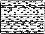
The typical representation of a cypress swamp marsh on a topographical map.

Cypress Swamp Marsh

The typical representation of a cypress swamp marsh on a topographical map.

The typical representation of a marsh in general (or fresh marsh) on a topographical map.

Fresh Marsh

The typical representation of a marsh in general (or fresh marsh) on a topographical map.
The typical representation of a salt marsh on a topographical map.

Salt Marsh

The typical representation of a salt marsh on a topographical map.

The typical representation of a wooded marsh on a topographical map.

Wooded Marsh

The typical representation of a wooded marsh on a topographical map.

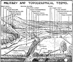
Terms used to define features of the earth on a topographical map used by the military.

Military and Topographical Terms

Terms used to define features of the earth on a topographical map used by the military.
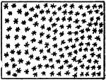
The typical representation of shores and low-water lines with mud on a topographical map.

Mud

The typical representation of shores and low-water lines with mud on a topographical map.

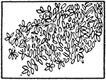
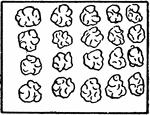
The typical representation of orchard on a topographical map.

Orchard

The typical representation of orchard on a topographical map.

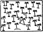
The typical representation of palm trees on a topographical map.

Palm Trees

The typical representation of palm trees on a topographical map.

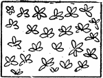
The typical representation of palmettos on a topographical map.

Palmetto

The typical representation of palmettos on a topographical map.

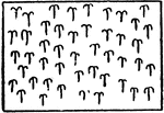
The typical representation of pine trees or any other narrow leaved trees on a topographical map.

Pine (or Narrow Leaved Trees)

The typical representation of pine trees or any other narrow leaved trees on a topographical map.

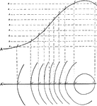
The development of polyconic projection: portraying a spherical object like the earth, on a flat surface.
Polyconic Projection

The development of polyconic projection: portraying a spherical object like the earth, on a flat surface.

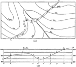
A profile of a road (b) could be constructed by using a topographical map (a).

Profile Construction

A profile of a road (b) could be constructed by using a topographical map (a).

Constructing a profile from a topographical map.

Profile Construction

Constructing a profile from a topographical map.

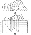
This diagram shows the translation from the profile of an incline to the contours in an above view.

Profile to Contours

This diagram shows the translation from the profile of an incline to the contours in an above view.

The topographical map is used to construct a hasty profile in order to determine visibility.

Hasty Profile

The topographical map is used to construct a hasty profile in order to determine visibility.

A profile is cross sectional view, or side view, showing elevation at a given distance. The illustration shows both profiles with and without vertical exaggeration. A profile with vertical exaggeration is useful to distinguish the elevation of the land.

Topographic Profiles

A profile is cross sectional view, or side view, showing elevation at a given distance. The illustration…

A diagram of the relief features: mountain, plateau, plain, ocean basin, ocean deep, and volcano.

Relief Features

A diagram of the relief features: mountain, plateau, plain, ocean basin, ocean deep, and volcano.
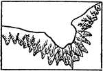
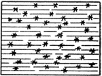
The typical representation of rice on a topographical map.

Rice

The typical representation of rice on a topographical map.

The typical representation of shores and low-water lines with rocky ledges on a topographical map.

Rocky Ledges

The typical representation of shores and low-water lines with rocky ledges on a topographical map.

The typical representation of shores and low-water lines with sand on a topographical map.

Sand

The typical representation of shores and low-water lines with sand on a topographical map.

The typical representation of sand dunes on a topographical map.

Sand Dunes

The typical representation of sand dunes on a topographical map.

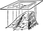
A perspective view of the shoreline illustrated by using contour lines.
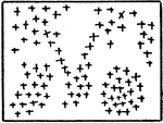
Perspective View of Shoreline

A perspective view of the shoreline illustrated by using contour lines.