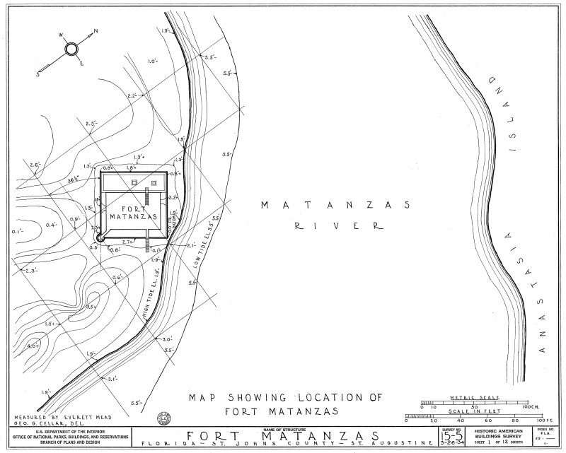
1934 Map Showing Location of Fort Matanzas, No. 15-5, US Department of the Interior, Office of National Parks, Sheet 1 of 12
This is a 1934 Map showing location of Fort Matanzas. The map details the various elevations around the fort. It is located on Rattlesnake Island and built along the Matanzas river inlet. Anastasia Island is directly across the Matanzas river. Plans produced by the Historic American Buildings Survey, U.S. Department of the Interior, National Park Services, Branch of Plans and Design.Galleries:Fort Matanzas Architectural Drawings, Forts and Fortifications, St. JohnsKeywords:Fort Matanzas National Park, Forts, Matanzas River, National Monument, Saint Augustine, Spanish fort, St. Augustine, St. Johns County, site plan, surveyPhoto Location: Fort Matanzas National Monument, St. Johns County, FloridaPhotographer: H. C. DozierDate of Photo: 04/10/1934Original Dimensions: 6000×4811Picture Orientation: LandscapeGPS Coordinates: 29°42′55″N 81°14′21″WPicture Number: 26669
WARNING: You are about to download a 2.0 MB TIFF!
Normally such a large file is only needed for high quality printing purposes. If you are certain that you need such a large file, click the DOWNLOAD button to begin.
If you do not wish to download the large TIFF, just click the × in the top right-hand corner to close this alert.