Mission of San Gregoiro de Abó Cover Sheet and Locator Map
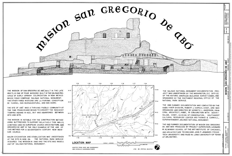
The Mission of San Gregoiro de Abó, built in the late 1620's, is one of four missions built in the Salinas province of early Spanish colonization in New Mexico which today comprise Salinas National Monument. The three other missions are La Purisma Conception de Cuarac, San Buenaventura, and San Isidro.
The site of Abó was a thriving pueblo community at the time Franciscans began to convert the resident Tompiro Indians in 1622, but was abandoned between 1672 and 1678.
The mission is notable for the construction method using buttresses to support relatively thin walls, a method used in European church architecture. San Gregoiro de Abó is the only example of the use of this method for a seventeennth-century New Mexican church.
WARNING: You are about to download a 2.7 MB TIFF!
Normally such a large file is only needed for high quality printing purposes. If you are certain that you need such a large file, click the DOWNLOAD button to begin.
If you do not wish to download the large TIFF, just click the × in the top right-hand corner to close this alert.