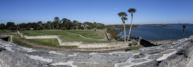
Northern View from the St. Charles Bastion of Castillo de San Marcos
This photograph was taken from the northeast bastion (St. Charles Bastion) of Castillo de San Marcos. The Matanzas River can be seen to the right. The different levels of the fort are apparent: the moat is closest to the fort's main walls and barely visible on the left side of the photo; the covered way is beyond the moat; the glacis is beyond the covered way. Fort Mose, site of the first legally sanctioned free African settlement, is located a few miles north of Castillo de San Marcos, although it cannot be seen in the photo.
Galleries: Castillo de San Marcos , Forts and Fortifications , St. Johns Keywords: baluarte de san carlos , bastion , bastion san carlos , bell tower , castillo de san marcos , covered way , exterior view of castillo de san marcos , florida , fort marion , fort mose , francis and mary usina bridge , glacis , looking north , main watch tower , matanzas river , moat , morning , national park service , saint charles bastion , sentry tower , st. augustine , st. charles bastion , terreplein , u.s. national monument , u.s. national register of historic places Photo Location: Castillo de San Marcos, St. Augustine, FloridaPhotographer: Dr. Roy WinkelmanDate of Photo: 12/18/2013Device Make: CanonDevice Model: Canon EOS 5D Mark IIExposure Time: 0.01F Number: 22Original Dimensions: 5545×1940Picture Orientation: LandscapeGPS Coordinates: 29°53′52″N 81°18′41″WPicture Number: 25603
