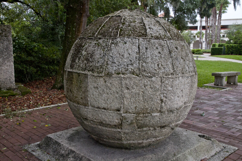
The Back of a Marker for the Eastern Terminus of the Old Spanish Trail
This large sphere marks the eastern terminus of the “Old Spanish Trail.” The trail traversed Spanish territory, from Florida to California. The sphere appears to have been constructed with coquina limestone blocks. This is the back of the marker.Galleries:Historic Signs, St. Augustine, St. JohnsKeywords:coquina, historic trail, old spanish trail, reverse sides of historic markers, saint augustine, st. augustine, stone sphere, trail, trail markerPhoto Location: St. Augustine, FloridaPhotographer: Dr. Roy WinkelmanDate of Photo: 10/08/2011Device Make: CanonDevice Model: Canon EOS 5D Mark IIExposure Time: 0.0166667F Number: 18Original Dimensions: 5616×3744Picture Orientation: LandscapeGPS Coordinates: 29°53'39.35"N 81°18'47.55"WPicture Number: 18509
WARNING: You are about to download a 51.1 MB TIFF!
Normally such a large file is only needed for high quality printing purposes. If you are certain that you need such a large file, click the DOWNLOAD button to begin.
If you do not wish to download the large TIFF, just click the × in the top right-hand corner to close this alert.