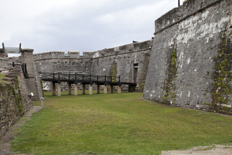
The bridge, in the distance, connects the ravelin to the fort. The path leading from the covered way to the ravelin can be seen, on the left margin of the photograph. The fort is a National Monument, and is listed on the National Register of Historic Places.Galleries:Castillo de San Marcos, Forts and Fortifications, St. Augustine, St. JohnsKeywords:bridge, castillo de san marcos, covered way, fort, fort marion, ravelin, saint augustine, st. augustinePhoto Location: St. Augustine, FloridaPhotographer: Dr. Roy WinkelmanDate of Photo: 10/08/2011Device Make: CanonDevice Model: Canon EOS 5D Mark IIExposure Time: 0.0166667F Number: 8Original Dimensions: 5616×3744Picture Orientation: LandscapeGPS Coordinates: 29°53'52.65"N 81°18'43.88"WPicture Number: 25118
WARNING: You are about to download a 60.2 MB TIFF!
Normally such a large file is only needed for high quality printing purposes. If you are certain that you need such a large file, click the DOWNLOAD button to begin.
If you do not wish to download the large TIFF, just click the × in the top right-hand corner to close this alert.