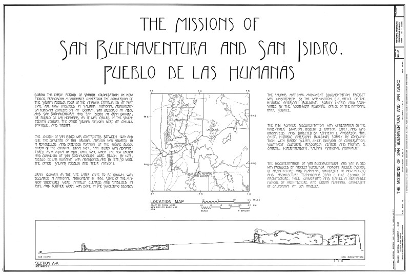
The Missions of San Buenaventura and San Isidro
The church of San Isidro was contracted between 1629 and 1631. The convent of this original mission was situated in a remodeled and extended portion of the house block north of the church. From 1631, San Isidro was administered as a visita of Abo, until 1659, when the new church and convent of San Buenaventura were begun. By 1672, Pueblo de Las Humanas was abandoned, and by 1678, so were the other Salinas pueblos and their Missions.
Gran Quivira, as the site later came to be known, was declared a national monument in 1906. Some of the mission structures were initially cleared and stabilized in 1923, and further work was done in the succeeding decades.
Drawing was downloaded from the Library of Congress Prints and Photographs Division Washington, D.C. and photo edited by the Florida Center for Instructional Technology.
WARNING: You are about to download a 1.7 MB TIFF!
Normally such a large file is only needed for high quality printing purposes. If you are certain that you need such a large file, click the DOWNLOAD button to begin.
If you do not wish to download the large TIFF, just click the × in the top right-hand corner to close this alert.