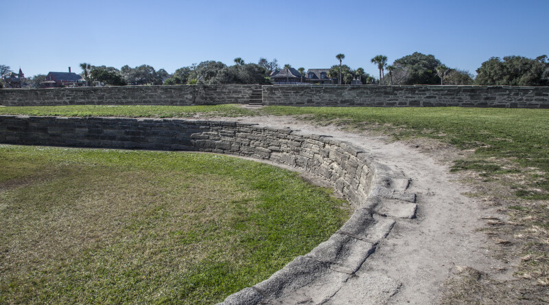
This photograph shows two separate walls at Castillo de San Marcos. The walls separate different levels of land leading up to the main walls of the fort. The level closest to the fort is the moat; the level beyond that is the covered way, which is the area between the two walls in the photo; the third level is beyond the furthest wall and is called the glacis.Galleries:Castillo de San Marcos, Forts and Fortifications, Stone WallsKeywords:afternoon, castillo de san marcos, covered way, florida, fort marion, moat, national park service, rounded coquina wall, st. augustine, u.s. national monument, u.s. national register of historic placesPhoto Location: Castillo de San Marcos, St. Augustine, FloridaPhotographer: Dr. Roy WinkelmanDate of Photo: 12/18/2013Device Make: CanonDevice Model: Canon EOS 5D Mark IIExposure Time: 0.01F Number: 22Original Dimensions: 5438×3023Picture Orientation: LandscapeGPS Coordinates: 29°53′52″N 81°18′41″WPicture Number: 27472
WARNING: You are about to download a 31.8 MB TIFF!
Normally such a large file is only needed for high quality printing purposes. If you are certain that you need such a large file, click the DOWNLOAD button to begin.
If you do not wish to download the large TIFF, just click the × in the top right-hand corner to close this alert.