Maps Site map
 Maps > Africa > A Regional Map of Africa
Site Map 

 Record  21   to   22  of   22

A collection of regional physical and political maps of Africa, including pre-colonial and colonial maps.
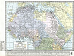
Post WWI Northern Africa, 1920
A political map of the northern part of the African continent after WWI with reference to territories controlled by European countries and showing the former German territories ceded by the Treaty of Versailles to France and Britain. This map include...

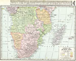
Post-WWI Central and Southern Africa, 1920
A map of central and southern Africa in 1920 showing colonial possessions of the British, French, Italian, Portuguese, Spanish, and Belgians, including the former German colonies, lost after WWI, to French and British control per the Treaty of Versai...

First Previous


 Maps > Africa > A Regional Map of Africa
Site Map 

Maps is a part of the Educational Technology Clearinghouse
Produced by the Florida Center for Instructional Technology © 2007
College of Education, University of South Florida