Maps Site map
  Maps > Asia > A Complete Map of Asia
Site Map  

  Record   61   to   70  of   71

Historic and contemporary maps of Asia, including physical and political maps, early exploration and colonization period maps, climate maps, relief maps, population density and distribution maps, vegetation maps, and economic/resource maps.
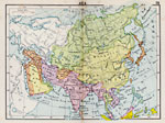
Asia, 1920
A map of Asia from 1920 showing country boundaries at the time, foreign possessions, capitals and other major cities, rivers, lakes, terrain, and coastal features. ...

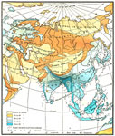
Average Annual rainfall in Asia, 1920
A map from 1920 showing the average annual rainfall in Asia. — New Geography Book two, 1920...

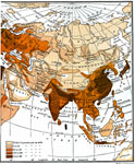
Population Distributions in Asia , 1920
A map from 1920 showing the population distributions in Asia....

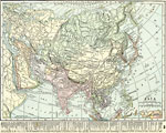
Asia, 1920
A map of Asia from 1920 showing country boundaries at the time, foreign possessions, major cities, rivers, lakes, terrain, and coastal features. This map shows the principal railways of the region with connections to Europe, and steamship trade route...

Asia, 1920
A map of Asia from 1920 showing country boundaries at the time, foreign possessions, major cities, rivers, lakes, terrain, islands, and coastal features. This map shows the principal railways of the region with connections to Europe, and steamship tr...

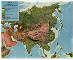
Land Regions of Asia, 1920
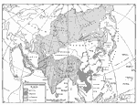
A color–relief map from 1920 of Asia showing the principal landform and vegetation features, river systems, and water features of the region. The map is keyed to show areas of waters less than 500 feet deep, floating ice, lands below sea level,...

Natural Regions of Asia, 1920
A map from 1920 of Asia showing principal physical features and natural regions. The map is color–coded to show lands below sea level, lowlands, uplands and plateaus, the older, worn down mountains, and younger, rugged mountains. The map shows ...

European Eminent Domain in Asia, 1921
A map from 1921 showing European and Japanese imperialist possessions in Asia at the time. The map is keyed to show the territories and islands claimed by the British, French, Japanese, and Russians. ...

Population Distribution of Asia, 1921
A base map of Asia from 1921 showing the general population distribution of the region at the time. "The climate of southeastern Asia is so warm and moist that food plants grow there in abundance. Nearly half the people of the world live in this...

Political Asia, 1922
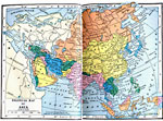
A map of Asia from 1922 showing country boundaries at the time, major cities, rivers, lakes, and coastal features. This map does not reference the Russian territory, but shows Siberia. China is not referred to as an empire, but includes the territori...

First Previous Next Last


  Maps > Asia > A Complete Map of Asia
Site Map  

Maps ETC is a part of the Educational Technology Clearinghouse
Produced by the Florida Center for Instructional Technology © 2009
College of Education, University of South Florida