Maps Site map
  Maps > Europe > Regional Maps >Southeastern Europe
Site Map  

  Record   41   to   43  of   43

Regional European maps of the Southeastern Europe region from the Maps ETC collection. This includes physical and political maps, early history and empires, WWI maps, climate maps, relief maps, vegetation maps, population density and distribution maps, cultural maps, and economic/resource maps.
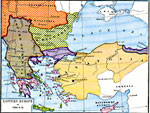
Eastern Europe, A.D. 1356
This map of Southeastern Europe shows the empires and territories in the Balkans and Anatolia at the time of Stefan Dushan's (Tsar of the Serbs and Greeks) death in A.D. 1356. This map shows Bohemia, Transsilvania (Transylvania), and Wallachia under ...

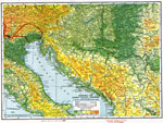
Dalmatia and Austro-Italian Frontier, October 20, 1918
Dalmatia, which is now part of Croatia, was part of the Austro–Hungarian Empire at the start of World War I. Dalmatia was occupied by Italy for a short time during World War I. The solid red line is the battle line on Oct. 20th, 1918. The dotte...

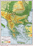
Balkan States, October 20, 1918
A map of the Balkan States during World War I. World War I started in the Balkans, when Archduke Franz Ferdinand of Austria was assassinated in Sarajevo, Bosnia in 1914. The solid red line is the battle line on Oct. 20th, 1918. The map is color&ndash...

First Previous


  Maps > Europe > Regional Maps >Southeastern Europe
Site Map  

Maps is a part of the Educational Technology Clearinghouse
Produced by the Florida Center for Instructional Technology © 2009
College of Education , University of South Florida