Maps Site map
  Maps > North America > Jamaica
Site Map  

  Record   1   to   2  of   2

Historic and contemporary maps of the island of Jamaica, for use in the K-12 classroom.

Jamaica, 1903
A map from 1903 of the Greater Antilles island of Jamaica showing parish boundaries, major cities, towns, and ports, railways, rivers, terrain and coastal features....

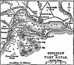
Kingston and Port Royal, 1919
A map from 1919 of the Jamaican capital city Kingston and nearby Port Royal, showing the harbor, forts Augusta, Charles, Henderson, and Passage, railway to Spanish Town, major roads, Hope River, Sandy River, and River Cobre, and coastal features in t...


  Maps > North America > Jamaica
Site Map  

Maps ETC is a part of the Educational Technology Clearinghouse
Produced by the Florida Center for Instructional Technology © 2009
College of Education, University of South Florida