Maps Site map
  Maps > North America > Mexico
Site Map  

  Record   31   to   34  of   34

A collection of historic and contemporary political and physical maps of Mexico, including early exploration and settlement maps, battle plans, and significant archeological sites.
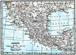
Mexico, 1919
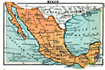
A map from 1919 of Mexico showing the major cities and towns, existing and proposed railroads, mountains, rivers, lakes, and coastal features of the country....

Mexico, 1920
A map from 1920 of Mexico showing the states and state capitals, major cities and towns, existing and proposed railroads, mountains, rivers, lakes, and coastal features of the country....

Mexico, 1920
A map from 1920 of Mexico showing major cities and ports, railroads with connections to the railroad network in the United States, shipping routes from New Orleans and San Francisco with distances given in nautical miles, rivers with heads of navigat...

Mexico, 1920
A map from 1920 of Mexico showing the states and state capitals, major cities and towns, existing and proposed railroads, mountains, rivers, lakes, and coastal features of the country. A grid–key in the margin references the locations of states...

First Previous


  Maps > North America > Mexico
Site Map  

Maps ETC is a part of the Educational Technology Clearinghouse
Produced by the Florida Center for Instructional Technology © 2009
College of Education, University of South Florida