Maps Site map
  Maps > United States > Agriculture
Site Map  

  Record   1   to   10  of   141

A collection of agricultural production and agricultural related maps in the United States for use in the K-12 classroom.

Value of Dairy Products, 1839
A map of the United States from the U. S. Department of Agriculture (1922) showing the dollar value of dairy products in 1839 by state. "The value of dairy products is the only measure of dairying available for 1839. The most important centers o...

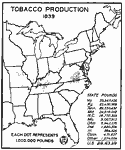
Tobacco Production, 1839
A map of the eastern United States from the U. S. Department of Agriculture (1922) showing tobacco producing areas and crop yield in 1839. Each dot represents 1,000,000 pounds of product. The total yield of tobacco for the United States in 1839 was 2...

Oat Production in the US, 1839
A map of the eastern United States from the U. S. Department of Agriculture (1922) showing oat production in 1839, given in bushels. Each dot represents 200,000 bushels. The total yield of oats for the United States in 1839 was 123,071,341 bushels....

Barley Production in the US, 1839
A map of the eastern United States from the U. S. Department of Agriculture (1922) showing the average yield of barley production in 1839. Each dot represents 100,000 bushels. The total yield of barley for the United States in 1839 was 4,161,504 bus...

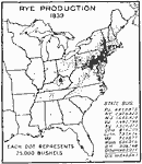
Rye Production in the United States, 1839
A map of the eastern United States from the U. S. Department of Agriculture (1922) showing the average yield of rye production in 1839. Each dot represents 25,000 bushels. The total yield of rye for the United States in 1839 was 18,645,567 bushels....

Buckwheat Production in the United States, 1839
A map of the eastern United States from the U. S. Department of Agriculture (1922) showing the average yield of buckwheat production in 1839. Each dot represents 25,000 bushels. The total yield of buckwheat for the United States in 1839 was 7,291,743...

United States Production of Hogs, 1840
A map of the United States from the U. S. Department of Agriculture (1922) showing the numbers and location of hogs produced in the United States in 1840. "The important centers of hog production in 1840 were in the earliest settled corn–g...

Where Wheat is Grown in the United States, 1840–1860
A map from 1911 of the United States showing the principal wheat–growing regions of the country between 1840 and 1860....

Cheese Made on Farms in the United States, 1849
A map of the United States from the U. S. Department of Agriculture (1922) showing the areas of the production of cheese made on farms by state in 1849. "Western New England, central and western New York and northeastern Ohio were the important ...

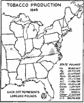
Tobacco Production, 1849
A map of the eastern United States from the U. S. Department of Agriculture (1922) showing tobacco producing areas and crop yield in 1849. Each dot represents 1,000,000 pounds of product. The total yield of tobacco for the United States in 1849 was 1...

Next Last


  Maps > United States > Agriculture
Site Map  

Maps ETC is a part of the Educational Technology Clearinghouse
Produced by the Florida Center for Instructional Technology © 2009
College of Education, University of South Florida