Maps Site map
  Maps > United States > Regional Maps >Southern States
Site Map  

  Record   11   to   20  of   30

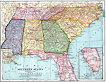
Southern Section of the United States, 1898
The southern section of the United States as of 1898. "Long, hot summers and short, temperate winters prevail over nearly the whole of this section. Although snow sometimes falls in all the states, it soon melts. Over nearly the whole section th...

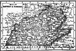
Kentucky and Tennessee, 1898
A map from 1898 of Kentucky and Tennessee. "Kentucky — Name Indian. Signifies dark and bloody ground, because the State was the hunting and battle ground of the tribes. Called ‘Corn Cracker State.’ Louisville founded 1780. Earl...

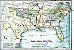
Southern States and Territories, 1899
A map from 1899 of the Southern States (Texas, Oklahoma and Indian Territory, Arkansas, Louisiana, Tennessee, Mississippi, Alabama, Georgia, Florida, North Carolina, and South Carolina) showing State capitals, major cities (names of cities with popul...

The Southern United States, 1901
The southern section of the United States....

Alluvial Valley and Delta of the Mississippi River , 1901
Alluvial Plain, Mississippi River....

Southern States, 1901
The southern states. ...

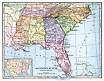
Southern States – Eastern Division, 1902
The southern United States....

Kentucky and Tennessee, 1902
Kentucky and Tennessee in 1902....

Southeastern States, 1906
The Southeastern States, showing physical features....

Southern States, 1909
The southern states. ...

First Previous Next Last


  Maps > United States > Regional Maps >Southern States
Site Map  

Maps is a part of the Educational Technology Clearinghouse
Produced by the Florida Center for Instructional Technology © 2009
College of Education , University of South Florida