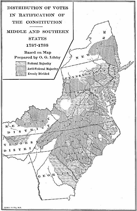
Description: A map showing the distribution of votes in the ratification of the Constitution (1787–1788) for the Middle and Southern States south of New England, including the Kentucky and Tennessee districts. The map is keyed to show areas where the vote was a Federal majority, where there was an anti-Federal majority, and areas where the vote was evenly divided.
Place Names: Early America 1400-1800, American Revolution, �constitutio
ISO Topic Categories: location,
boundaries
Keywords: Distribution of Votes in Ratification of the Constitution, physical, �political, physical features, major political subdivisions, location,
boundaries, Unknown, 1787–1788
Source: Albert Bushnell Hart, LL.D., The American Nation Vol 10 (New York, NY: Harper and Brothers, 1906) 278
Map Credit: Courtesy the private collection of Roy Winkelman |
|