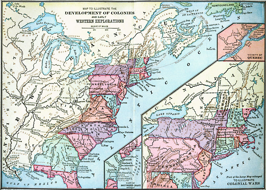
Description: A map of eastern North America showing the early development of the European colonies and westward exploration to the Mississippi River. The map shows the routes of several early explorers with dates of exploration, including La Salle, Hennepin, Marquette and Joliet, and the sea routes of the military voyages north to Canada by Monckton, Walker, and Wolf. The names of native tribes are shown in their respective territories, and early forts and trading centers are shown with dates of establishment. Inset maps detail the area around Quebec, an enlargement of the East Coast to illustrate the Colonial Wars, and an enlargement of the southern coast.
Place Names: Early America 1400-1800, Bahamas, �Canada, �Cuba, �Mexico, �United State
ISO Topic Categories: oceans,
location,
inlandWaters
Keywords: Development of Colonies and Early Western Explorations, Colonial Wars, �historical, �water routes, other military, oceans,
location,
inlandWaters, Unknown, 1700–1775
Source: A. S. Barnes, A Brief History of the United States (New York, NY: American Book Company, 1885)
Map Credit: Courtesy the private collection of Roy Winkelman |
|