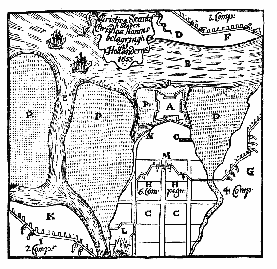
Description: A facsimile of the plan of Fort Christina at the confluence of Brandywine Creek and Christina Creek near the Delaware River (beyond right margin of map) during the siege by the Dutch in 1655. The Swedish fort was a primary objective of the Dutch in their campaign to return New Sweden territory in the Delaware Bay to New Netherlands. The map is keyed to show: (A) Fort Christina; (B) Christina Creek; (C) town of Christina Hamn; (D) Tennekong Land; (E) Fiske Kil (now Brandywine Creek); (F) Snake Battery, of four guns; (G) Gnat Battery, of six guns; (H) Rat Battery, of five guns; (I) Fly Battery, of four guns; (K) Timmer Öland (Timber Island); (L) kitchen; (M) position of the besiegers; (N) harbor; (O) mine; (P) reed flats; and ‘Comp’ — Companies of Dutch soldiers.
Place Names: Early America 1400-1800, Delaware, �Pennsylvania, �Colonial America, �Discovery, �Swedes, �Sweden, �Dutch, �New Netherland, �New Swede
ISO Topic Categories: oceans,
location,
inlandWaters
Keywords: Siege of Christina Fort, borders, �physical, �historical, kEarlyMapsFacsimile, physical features, other military, oceans,
location,
inlandWaters, Unknown, 1655
Source: Justin Winsor, Narrative and Critical History of America (vol. 4) (Boston, MA: Houghton, Mifflin, and Company, 1884) 480
Map Credit: Courtesy the private collection of Roy Winkelman |
|